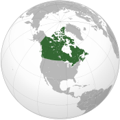
Volunteers and food needed for flooded Manitoba, Canada
Tuesday, March 31, 2009

Image: Kmusser.
Local municipal and provincial volunteers in Manitoba, Canada are exhausted in their efforts to divert the rising waters of the Red River of the North.
It has been hard work with little sleep for the residents who live on the shores of the Red River to shore up their defences with sandbags, build dikes, clear frozen culverts and break ice jams
Volunteers to spell relief for local volunteers and food are desperately needed.
"It's a week now we've been doing this ... you're talking four, five, six public works guys. In my one community we've got 25 volunteer firefighters and those guys have been going 24/7, so of course it's wearing them down." said Paul Guyader, Manitoba's emergency measures coordinator.
"We're dealing with one of the biggest floods the province has ever seen," said Steve Strang, mayor of St. Clements, Manitoba "We've put out hundreds of thousands of bags already. The municipalities are working very well, we're working with the provincial government, we've brought in every possible resource we could to address this issue. The volunteerism within the community has been phenomenal."
The Portage Diversion has taken some spring waters from the Assiniboine River and diverted the flow to Lake Manitoba.
Roseau River Anishinabe First Nation has been totally evacuated, as well as many homes near the Canada – United States border.

Image: Kmusser.
The cold weather is freezing the ice jams into place. Guyader has had 2 Amphibex Excavators operating on the river breaking up ice.
The Red River is right now 16.7 feet (5 metres) above spring ice conditions. The Red River Floodway gates cannot be opened with the current ice jams.
"If we operate now, we can get ice jamming going into the floodway, jamming up against the St. Mary's bridge, as such, the floodway capacity would be reduced and would cause higher water levels in the city of Winnipeg." said Steve Topping, Manitoba Water Stewardship spokesman
The floodway was constructed in 1968 following the 1950 flood to divert the overflow spring flooding waters of the Red River. The floodway has been widened the since the 1997 “flood of the century" and the expansion is expected to be completed this spring. As well Manitoba built permanent dikes around communities within the flood plain since the last two major floods..
The Red River waters will crest between the beginning of April to mid April, at which time also the weather should be warming up. Communities are bracing for higher water levels, more ice jams as well as melting snow in the warmer spring temperatures.
Related news
- "Fargo, North Dakota, prepares for record flooding" — Wikinews, March 24, 2009
- "Manitoba residents receive evacuation flood alerts" — Wikinews, March 28, 2009
Sources
- "Manitoba flood crews worn down Exhaustion new enemy in war against rising river" — The Canadian Press, March 30, 2009
- "Flood-threatened communities plead for volunteers and food" — CBC, March 30, 2009
- Canada News. "Manitoba workers battle flooding, exhaustion" — Bell Canada, Microsoft Corporation, March 30, 2009


